
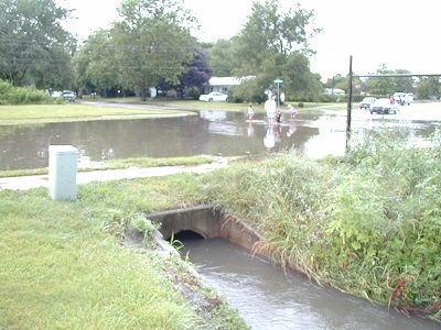
Stormwater Flooding
Urbana’s Stormwater Flood Control Program consists of the following four key parts:
-
Stormwater Collection System Infrastructure - Urbana designs, constructs and operates storm sewers, detention ponds, culverts and open channel ditches to minimize flooding.
-
Land Development - Urbana manages land use and reviews developments for compliance with City Stormwater and Flood Prevention Ordinances.
-
Citizen Response – Urbana responds to citizen complaints of flooding.
-
Stormwater Collection System Maintenance – Urbana does routine maintenance on the stormwater collection system. Maintenance consists of cleaning sewers, root removal from sewer lines, removing debris and sediment from ditches/channels, and cured-in-place sewer lining.
The Federal Emergency Management Agency (FEMA) has prepared new flood insurance rate maps (FIRM) for the City of Urbana. These new maps will be effective starting on Wednesday, October 2, 2013 and will be replacing the exisiting maps that date back to the 1980s. The new maps were created as part of FEMA's Map Modernization Project. The project incorporated aerial photography, digital terrain models, and the latest hydrological/hydraulic studies to create new digital flood hazard maps. The new maps can be viewed by clicking here.
FIRM maps graphically show whether or not parcels of land are located within the floodplain. The FIRM maps are used to determine premiums for homeowners' flood insurance policies. Properties within the floodplains have development restrictions.
| Attachment | Size |
|---|---|
| 678.84 KB | |
| 2.86 MB |